Home /
Expert Answers /
Civil Engineering /
b-using-the-field-profile-leveling-data-tabulated-in-the-table-three-calculate-the-reduce-level-us-pa602
(Solved): b) Using the field profile leveling data tabulated in the table three calculate the reduce level. Us ...
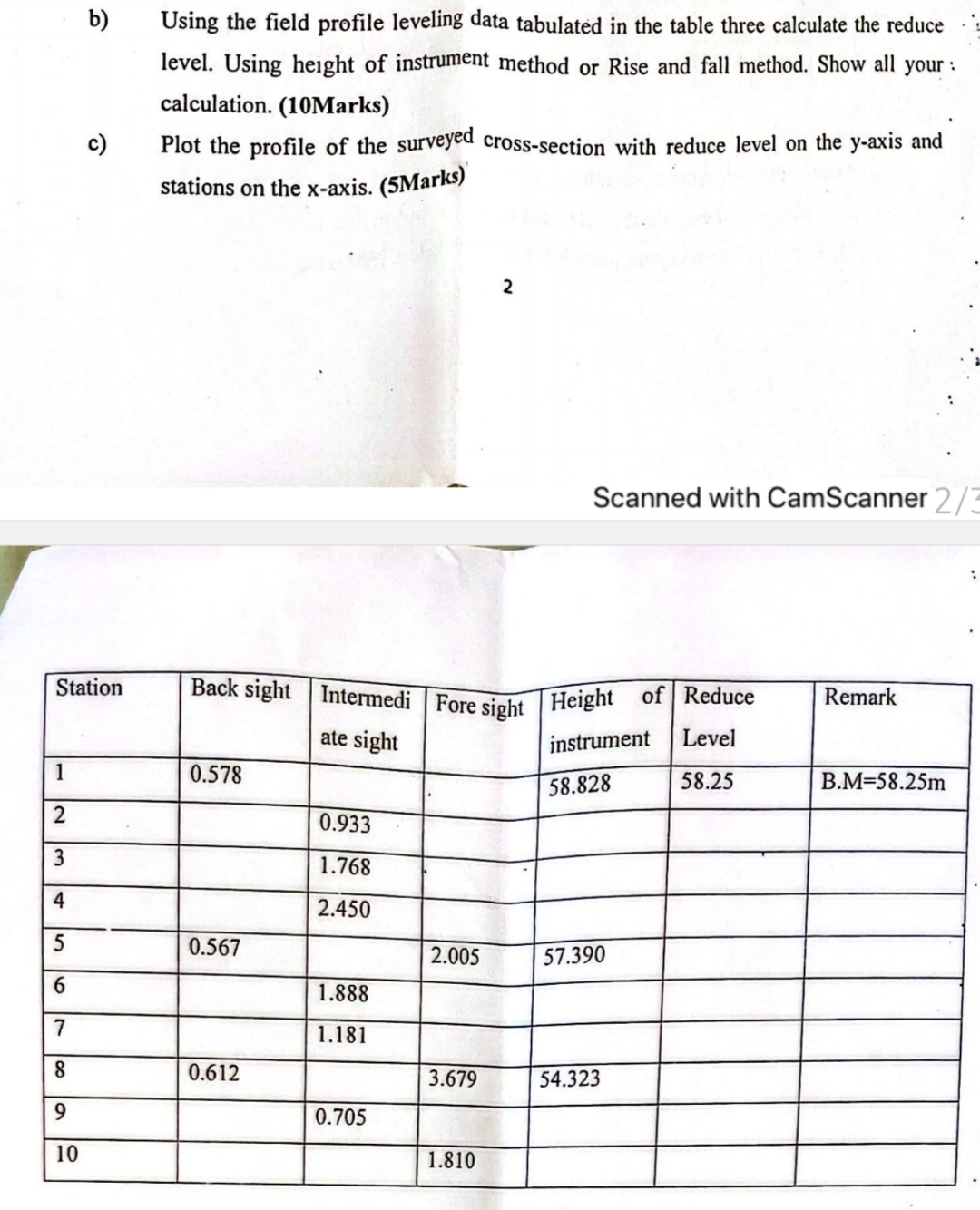
b) Using the field profile leveling data tabulated in the table three calculate the reduce level. Using height of instrument method or Rise and fall method. Show all your : calculation. (10Marks) c) Plot the profile of the surveyed cross-section with reduce level on the
y-axis and stations on the x -axis. (5Marks) 2 Scanned with CamScanner \table[[Station,Back sight,Intermedi ate sight,Fore sight,Height of instrument,Reduce Level,Remark],[1,0.578,,,58.828,58.25,B.M
=58.25m